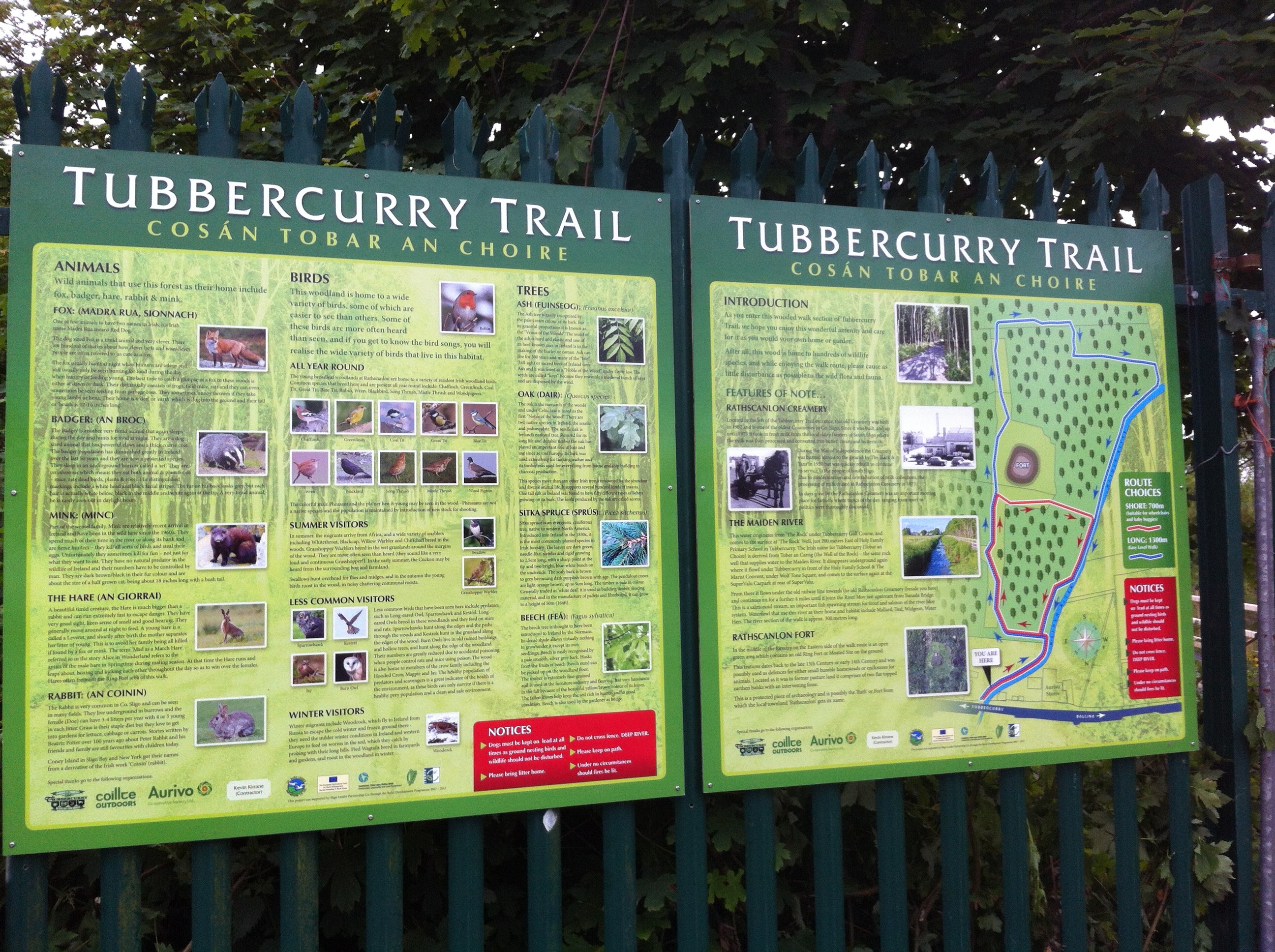
Forest Walk in Tubbercurry
A beautiful Forest Walk has been developed by Tubbercurry Chamber of Commerce & Community Association on Coillte owned land at rear of the old Rathscanlon Creamery, Tubbercurry. Beside the entrance at the old Rathscanlon Creamery on the Ballina Road.
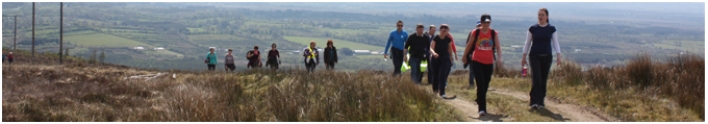
Guided Walks – Ox Mountains
Aclare – Fidon Slí na Slainte
The route commences in Aclare Village, take the left turn which is opposite Gallagher public house and continue on this road for approx 2 km passing a farm yard on you right, immediately after the farmyard turn left at Gurrie’s Corner. Continue straight on this road; turn right at the next junction , Nealon’s Corner. Continue on the Coolerecuil Road, passing by a farmyard on your left. Up Carn’s Hill and at the top of the hill turn left onto the Aclare/Tourlestrane Road and return to the village.
• Distance: 4.8 km.
• Duration: 1.5 to 2 hours.
• Grade: Easy to Moderate.
• Essentials: Good walking boots or shoes, mobile phone and fluids.
Kilmactigue – Carrowreagh Sli na Slainte
This route begins at Kilmactigue Church close to the old national school, continue up a hill keeping left; stay on this road passing over a small bridge and then taking the next turn to the right; proceed on this road until you come out onto the Carraloban / Aclare Road, turn right, pass over Carrolobane Bridge. After the bridge take the road to the right; and keep on this road until you return back to Kilmactigue Church.
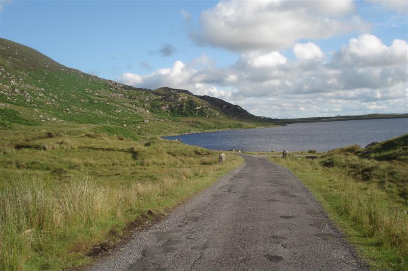
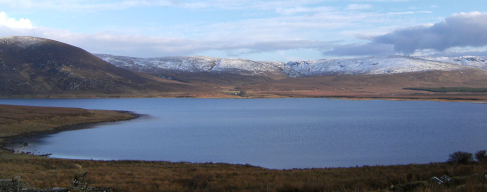
Lough Easkey – National Loop Walk
This walk traces the shores of Lough Easkey, a peaceful and scenic lake surrounded by forest plantations. The blanket bog on this route is designated a special area of conservation boasting rare types of moss and threatened bird species like the Greenland white fronted goose and Irelands only native reptile the common lizard has also been spoted here.
The Route
Starting from the carpark on the left, this remote nature trail crosses blanket bog with a combination of of forest tracks, laneways and minor roads, leading walkers into the Ox Mountains, offering stunning lakeshore views from part of the Sligo Way.
• Distance: 6 km.
• Duration: 1.5 hours.
• Grade: Moderate.
• Essentials: Walking boots, Raingear, Walking Stick.
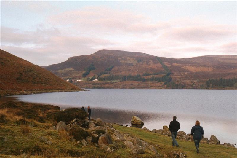
Lough Talt Loop Walk
This is a remarkably scenic walk around the shores of picturesque Lough Talt. The lake and its surroundings are home to a diverse range of bird life, with wild ducks, swans and dippers to be seen overhead. The lake also boasts an abundance of brown trout, making it a popular destination with anglers.
The Route
The first section of this walk is along a lake shore track with the return journey along a busy road. For this reason families with young children may prefer to make their return back along the same track.
Follow the track along the western shore of the lake. Head uphill from the lake, past the ruins of some houses, through the gates and onto an old road. Take a right turn onto the R 294 near the gap and follow the main road back along the eastern side of the lake shore.
• Distance: 5.5 km.
• Duration: 1.5 hours.
• Grade: Easy
• Essentials: Walking boots/shoes, Raingear, Walking Stick, Refreshments & Food, Mobile Phone
The above walks and walks that are in our brochure “Walking & Cycling in the Ox Mountains” can be done without a guide but for walks that are part of the Walking Festival Routes a guide is necessary, as they have a knowledge of the walking route and more importantly all Ox Mountain Dev. Company Guides have permission of the local farmers and landowners .
The services of a walking leader guide can be hired through the Ox Mountain Development company. All guides have their own insurance and it is advisable for walkers to take adequate personal insurance out before undertaking a walk on any of the routes.
All guides are from the locality and have good knowledge of the local history and folklore.